
Every destination should be easier to find.
Hospitals, campuses, and large healthcare complexes can be stressful to navigate. Paadha delivers dedicated indoor maps and digital wayfinding — guiding patients, bystanders, and visitors through multi-floor corridors directly to their department or room.

Structured mapping across complex blocks and multi-level buildings
Interactive digital companion application launched instantly via QR or link
Every destination, lift, ramp, and corridor checked with facility administration
Controlled updates for relocated departments, room renames, and seasonal clinics
Finding the right place shouldn't be complicated.
When buildings grow, finding a room becomes an obstacle course. In critical environments like hospitals, every minute lost in unfamiliar corridors carries a real human cost.
Unfamiliar & Expanding Buildings
Modern institutional complexes consist of multiple blocks built over decades, confusing corridors, and wing renames that disorient first-time visitors.
Multi-Floor Complexity
Destinations spread across basements, mezzanines, and tower floors. Physical signage is often fragmented or missing at critical junction turns.
Patient & Bystander Stress
In healthcare environments, visitors are already under emotional distress. Searching for diagnostic labs, blood banks, or ICU wards adds unnecessary anxiety and delays.
Staff Interruption Burden
Frontline hospital staff, nurses, and security guards spend hours every shift giving repetitive directional assistance instead of focusing on clinical care.
Designed specifically for high-stress healthcare environments
Paadha reduces wayfinding cognitive load so patients reach their appointment or emergency zone with confidence.
A clearer way to navigate indoor spaces.
Paadha connects spatial mapping, structured destination directories, and verified circulation paths into one unified digital wayfinding solution.
How Paadha gets deployed.
A structured, facility-specific implementation process ensuring map accuracy, verified routes, and seamless visitor adoption.
Assess the Facility
We survey the target buildings, evaluate architectural CAD drawings or floor plans, catalogue key wings, and define the project mapping scope.
Prepare the Digital Map
Our team converts architectural drawings into optimized, multi-layer digital wayfinding maps with clearly labelled corridors and vertical connections.
Validate Destinations & Routes
Every point of interest, room name, lift access, corridor connection, and transit route is reviewed on-site with facility administrative staff.
Deploy Navigation Experience
We configure physical QR code access points, web links, and internal directories so patients and visitors can start navigating immediately.
Tailored for complex indoor spaces.
While healthcare is our foundational deployment focus, Paadha's digital wayfinding architecture addresses large and confusing spaces across multiple sectors.
Healthcare & Hospitals
Outpatient departments, diagnostic centers, multi-block wards, emergency units, and pharmacies. Reduce patient stress and eliminate transit delays in critical care facilities.
- checkOPD & Ward Wayfinding
- checkDiagnostic Lab Navigation
- checkElevator & Wing Routes
- checkVerified at GMC Kozhikode
Education & University Campuses
Academic blocks, multi-story libraries, lecture auditoriums, science laboratories, and administrative offices across expansive educational campuses.
- checkDepartment Blocks
- checkExamination Hall Guidance
- checkCampus Amenities Discovery
- checkNew Student Orientation
Retail & Shopping Malls
Multi-floor commercial centers, store directories, brand discovery, food court routing, parking access, and customer service counters.
- checkInteractive Store Directory
- checkMulti-Level Shopping Guidance
- checkRestrooms & Amenities
- checkKiosk / Mobile QR Access
Corporate Offices & IT Parks
Large corporate campuses, tech parks, client reception, conference suites, departmental wings, and employee shared amenities.
- checkMeeting Room Discovery
- checkVisitor Reception Paths
- checkCross-Wing Navigation
- checkFacility Management Integration
Transport & Public Facilities
Transit terminals, civic secretariats, government buildings, court complexes, and public service halls requiring clear public orientation.
- checkGate & Counter Discovery
- checkMulti-Floor Public Paths
- checkClear Signage Integration
- checkHigh-Footfall Layouts
Hospitality & Convention Centers
Hotel complexes, exhibition centers, conference halls, banquet spaces, and resort grounds with dynamic event configurations.
- checkEvent Hall Wayfinding
- checkGuest Amenity Discovery
- checkMulti-Wing Circulation
- checkDynamic Temporary Placards
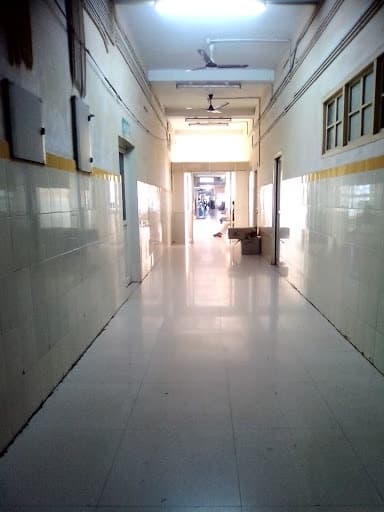
Government Medical College Kozhikode
Indoor wayfinding and destination discovery across hospital wings.
Hospital Navigation in Practice
Government Medical College Kozhikode is one of the largest tertiary healthcare and teaching institutions in the region. Spanning multiple blocks, high daily patient footfall, and intricate department networks, navigating the campus presents real challenges for patients and their bystanders.
Paadha was introduced to map core hospital wings, OP clinics, registration counters, diagnostic facilities, and blood bank utilities into an accessible digital wayfinding guide. Visitors launch the interactive application directly on their mobile phones to view verified pathways.
Configured corridor navigation covering clinical departments and critical care units.
Instant starting point orientation via strategically deployed QR codes at hospital entrances.
Built on practical execution, not guesswork.
We focus on the real-world operational realities of complex institutional facilities — where accuracy, reliability, and human usability matter most.
Practical, Facility-Specific Implementation
We do not use generic, auto-generated layouts. Every digital map is customized to your actual building floor plans, current functional usage, and operational guidelines.
Organized Around Real Visitor Needs
Destinations are indexed not just by administrative room numbers, but by the practical names, doctor specialties, diagnostic categories, and services patients actually search for.
Configurable Mapping Scope
Start with high-traffic zones like outpatient blocks, diagnostic labs, and emergency corridors, then scale across additional towers, basements, or external campus grounds as needed.
Structured On-Site Validation Process
Before public launch, mapped corridors, elevator availability, multi-floor routes, and destination markers are validated on the ground alongside facility coordinators.
Continuous Maintenance & Change Management
Hospitals and institutions evolve constantly. Our administrative workflows ensure updated clinic relocations, temporary block closures, and room renumbering are quickly reflected.
Instant-Launch Application Architecture
The Paadha application loads immediately in any mobile browser via QR code scan or direct web links, giving visitors full navigation capabilities on their device with zero setup delay.
Ready to make your building easier to navigate?
Tell us about your facility and the destinations visitors need to find. We'll discuss your mapping requirements, deployment approach, and next steps.